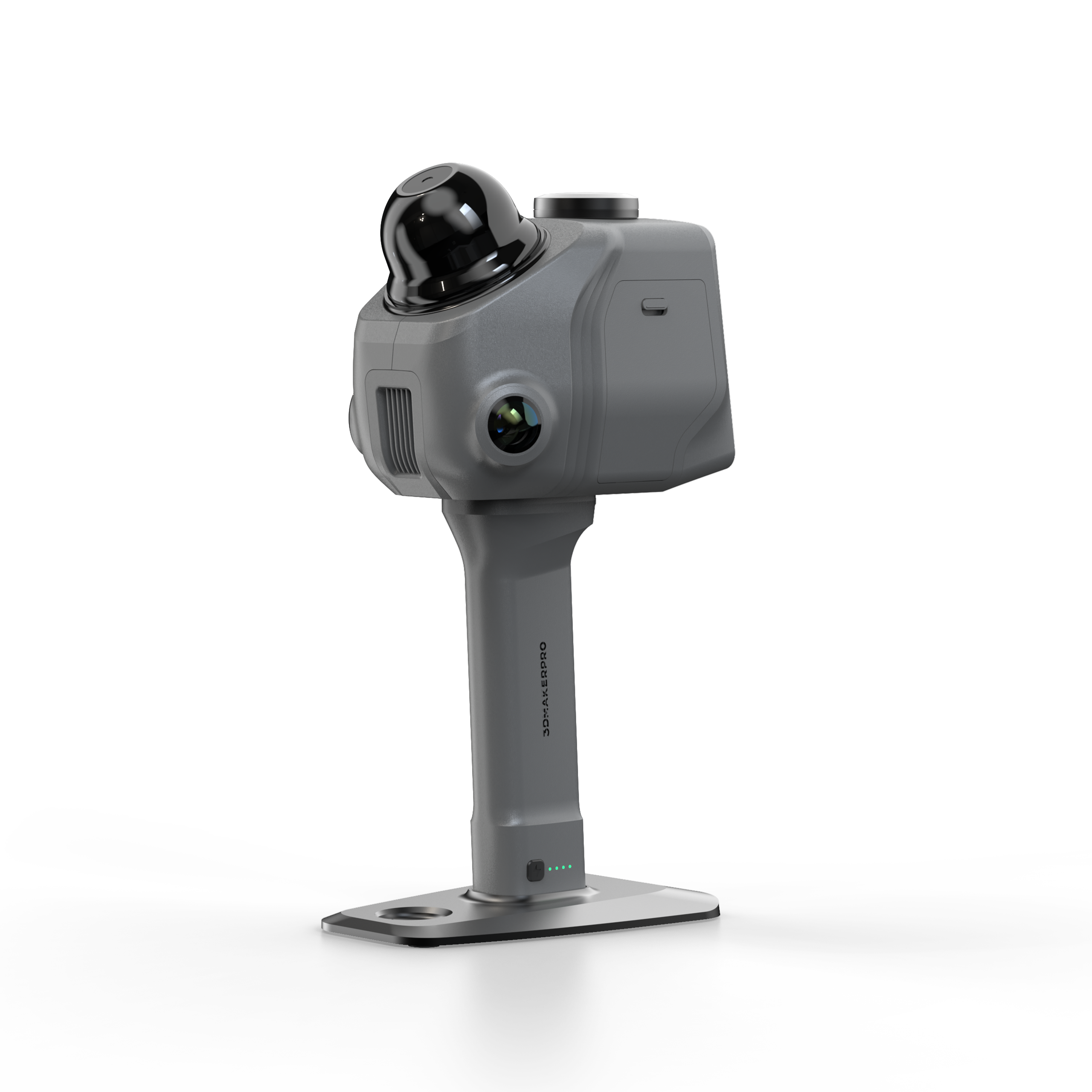
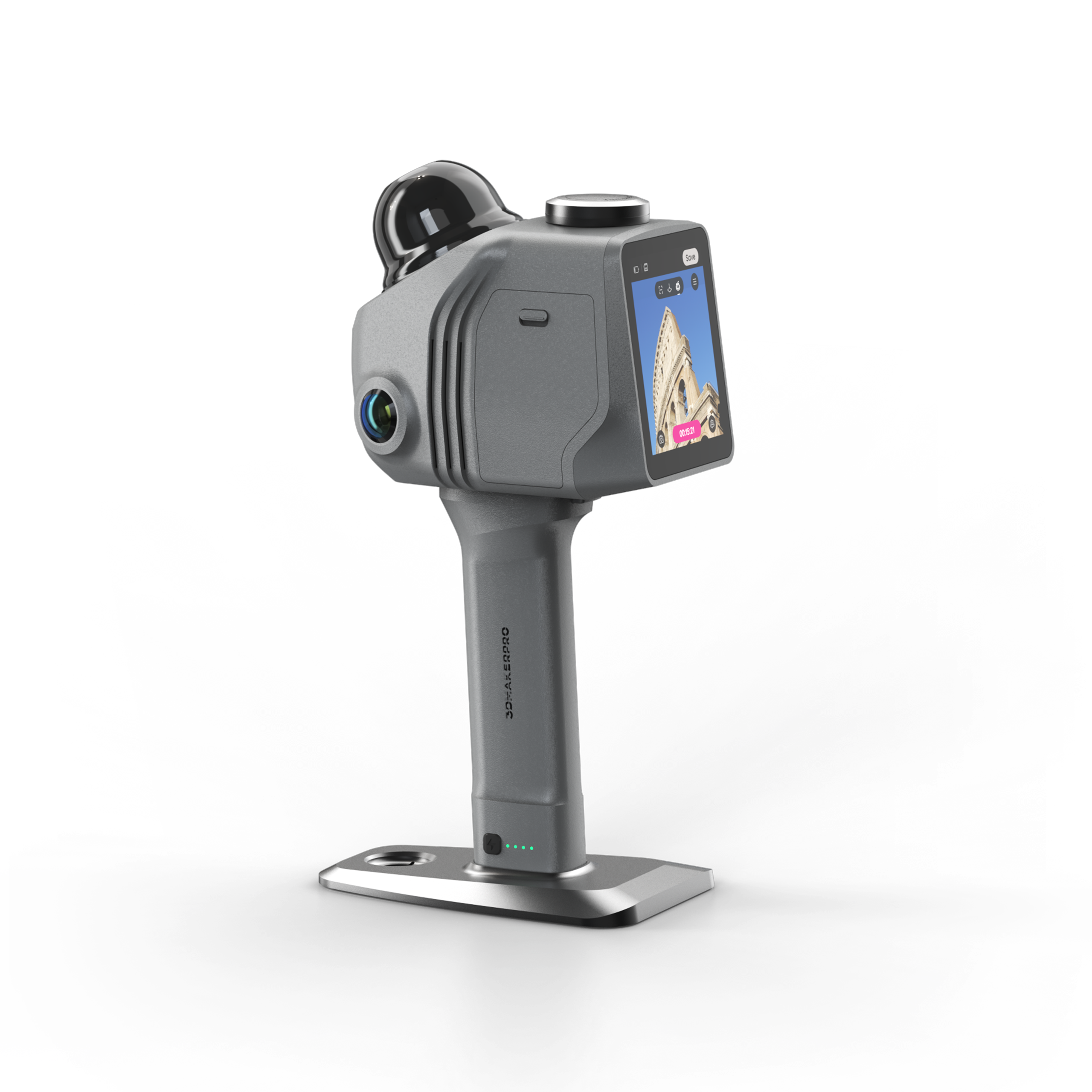
3DMakerPro Raven Max RTK SLAM LiDAR Scanner
The 3DMakerPro Raven Max RTK is the survey-grade tier of the Raven SLAM LiDAR line. It ships with the RTK Kit included, so every scan can be tied to absolute real-world coordinates for surveying, mapping, construction and infrastructure documentation.
RTK, short for Real-Time Kinematic positioning, adds centimeter-level georeferencing on top of the Raven engine. Where the standard and Max models produce locally accurate point clouds, the Max RTK places those clouds in a true coordinate system, which is what survey, GIS and engineering teams need for deliverables that align with site control and existing datasets.
Like the Raven Max, this model carries dual 12 MP cameras for rich true-color texture and a 905 nm LiDAR engine that holds 2 cm accuracy at 10 m across an 80 to 100 m range. A 360 degree by 40 degree field of view, 150,000 points per second and a 1.1 kg body let one operator georeference a site in a single walk-through, then export straight into CAD, BIM and GIS workflows.
What's Included:
- 3DMakerPro Raven Max RTK LiDAR scanner (2 x 12 MP cameras)
- RTK Kit for georeferenced positioning
- Battery grip
- Holder base
- 128GB TF card
- Charging and data cables
- Protective carrying case
Features
RTK Kit Included for Survey-Grade Georeferencing
The bundled RTK Kit adds centimeter-level Real-Time Kinematic positioning, so scans land in absolute coordinates that align with site control and existing survey datasets.

Georeferenced Point Clouds for CAD, BIM and GIS
Because positions are absolute, the output drops directly into surveying, GIS and engineering deliverables without manual registration to known control points.

Dual 12 MP Cameras for True-Color Capture
Two 12 MP cameras record 4K true-color texture and support Gaussian splatting, so georeferenced point clouds also carry photorealistic RGB detail.

SLAM Fused With GPS and IMU
Raven Max RTK combines LiDAR, IMU, visual data and RTK GPS to reduce drift and improve alignment accuracy during real-time capture.

2 cm Accuracy Over an 80 to 100 m Range
The 905 nm LiDAR engine holds 2 cm accuracy at 10 m, 3 cm at 20 m and 5 cm at 40 m, scanning from 80 to 100 m at 150,000 points per second.

Lightweight Field Body With Swappable Battery
At 1.1 kg with a quick-swap battery good for up to 120 minutes, the Max RTK keeps long survey sessions moving on foot, on a tripod or on optional mounts.

What's Included
Included with Your Purchase:
- 3DMakerPro Raven Max RTK LiDAR scanner (2 x 12 MP cameras)
- RTK Kit for georeferenced positioning
- Battery grip
- Holder base
- 128GB TF card
- Charging and data cables
- Protective carrying case
- RayStudio software access (free)
Specifications
| Cameras | 2 x 12 MP with RTK Kit included |
| Positioning | RTK Kit included |
| Accuracy | 2 cm at 10 m, 3 cm at 20 m, 5 cm at 40 m |
| Scan Radius | 40 m at 10% reflectivity, 50 m at 80% reflectivity |
| Scan Range | 80 to 100 m |
| Field of View | Horizontal 360 degrees, Vertical 40 degrees |
| Point Cloud Frequency | 150,000 points per second |
| Laser Light Source | 905 nm |
| Eye Safety | Class 1 (IEC60825-1:2014) |
| Weight | 1.1 kg |
| Battery Runtime | Up to 120 minutes per swappable battery |
| Software | RayStudio included, JIMUMETA cloud platform |
FAQ
Q: What does RTK add to the Raven Max RTK?
A: RTK, or Real-Time Kinematic positioning, adds centimeter-level georeferencing. It places your point clouds in absolute real-world coordinates, which is what survey-grade and GIS workflows require.
Q: Is the RTK Kit included or sold separately?
A: The RTK Kit is included with the Raven Max RTK. The standard Raven and Raven Max accept an optional RTK module, while this model ships with it in the box.
Q: How accurate is the Raven Max RTK?
A: The LiDAR engine holds 2 cm accuracy at 10 m, 3 cm at 20 m and 5 cm at 40 m, and the RTK Kit adds absolute coordinate positioning on top of that.
Q: Does it still capture color data?
A: Yes. It carries dual 12 MP cameras that record 4K true-color texture, so your georeferenced point clouds also include photorealistic RGB detail and support Gaussian splatting.
Q: What can I export to?
A: The included RayStudio software processes and optimizes the point cloud and exports to CAD, BIM and GIS formats. The JIMUMETA cloud platform handles hosting and sharing.
Q: What range and capture speed does it offer?
A: It scans from 80 to 100 m at 150,000 points per second, with a usable radius of 40 m at 10% reflectivity and 50 m at 80% reflectivity.