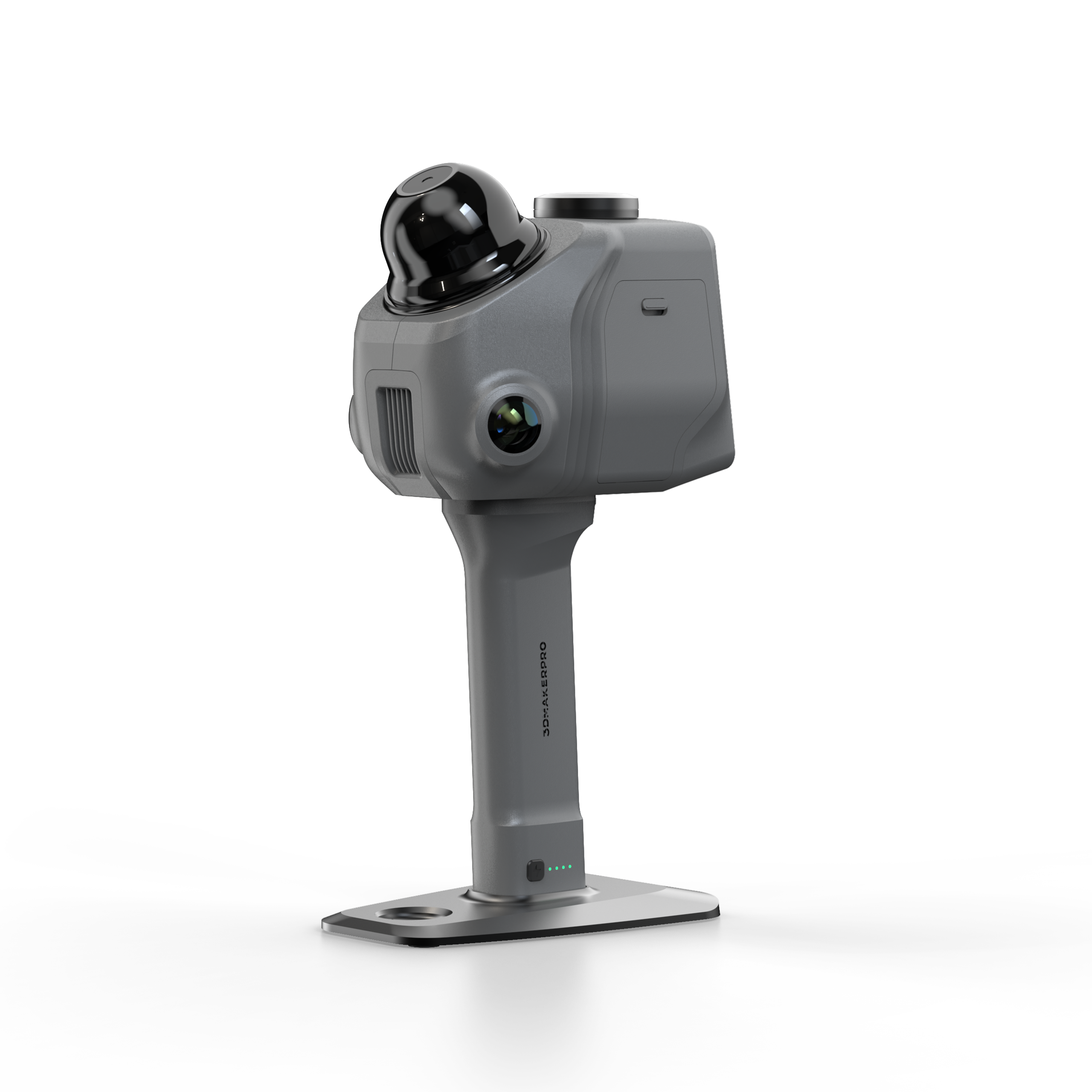
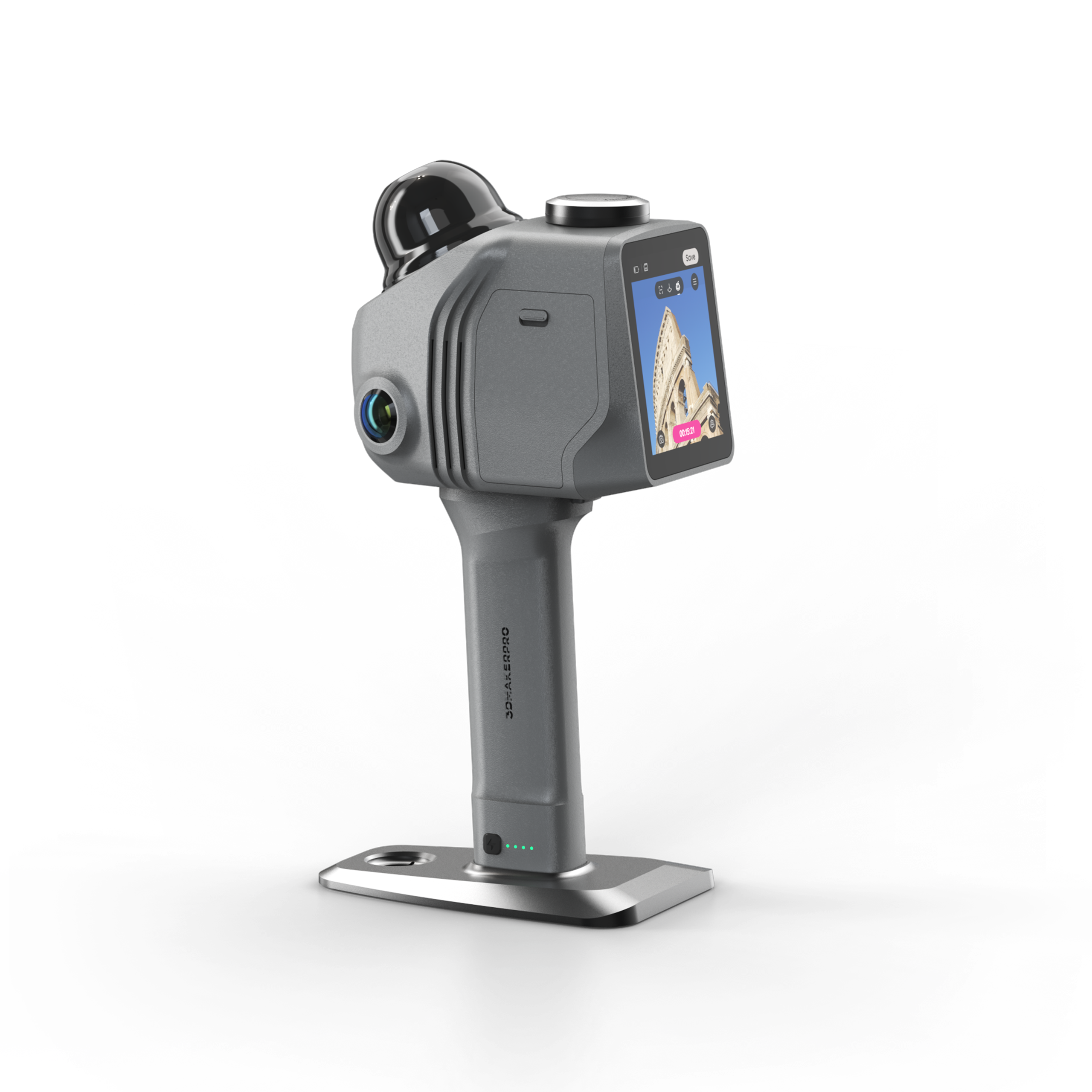
3DMakerPro Raven Max SLAM LiDAR Scanner
The 3DMakerPro Raven Max is a lightweight SLAM LiDAR scanner built for surveying, construction, real estate and digital twin work. It captures large indoor and outdoor sites in minutes and turns them into colorized 3D point clouds that move straight into CAD and BIM workflows.
The Max steps up from the standard Raven by adding a second 12 MP camera. The dual 12 MP system records more true-color texture from a wider angle, so the resulting point clouds carry richer RGB detail for photorealistic digital twins and Gaussian splatting. It pairs the cameras with a 905 nm LiDAR engine that reaches up to 100 m and holds 2 cm accuracy at 10 m.
A 360 degree by 40 degree field of view and 150,000 points per second let one operator cover a space in a single walk-through. At 1.1 kg the Raven Max stays light in the hand, and the swappable battery keeps long field sessions running. It is the right tier for teams that want denser color data without the survey-grade RTK module.
What's Included:
- 3DMakerPro Raven Max LiDAR scanner (2 x 12 MP cameras)
- Battery grip
- Holder base
- 128GB TF card
- Charging and data cables
- Protective carrying case
Features
Dual 12 MP Cameras for Richer Color
Two 12 MP cameras capture more true-color texture across a wider angle than the single-camera Raven, so point clouds carry denser RGB detail for realistic digital twins.

4K Color Texture and Gaussian Splatting
The dual camera system records 4K true-color texture and supports Gaussian splatting workflows for photorealistic visual reconstructions of a scanned space.

SLAM-Based Real-Time Mapping
Raven Max fuses LiDAR, IMU and visual data to track its own position as you move, so you capture accurate point clouds in real time with minimal setup.

2 cm Accuracy at 10 m
The 905 nm LiDAR engine holds 2 cm accuracy at 10 m, 3 cm at 20 m and 5 cm at 40 m for dependable professional spatial data.

Wide 360 by 40 Degree Field of View
A full 360 degree horizontal sweep with a 40 degree vertical window reduces blind spots and lets you map a space in a single pass at 150,000 points per second.

Swappable Battery for Continuous Fieldwork
Each battery supports up to 120 minutes of scanning and swaps out quickly, so long field sessions continue without waiting for a recharge.

Lightweight 1.1 kg Handheld Body
At 1.1 kg the Raven Max stays comfortable for handheld walk-and-scan capture, on a tripod or on optional bicycle, rooftop and backpack mounts.
What's Included
Included with Your Purchase:
- 3DMakerPro Raven Max LiDAR scanner (2 x 12 MP cameras)
- Battery grip
- Holder base
- 128GB TF card
- Charging and data cables
- Protective carrying case
- RayStudio software access (free)
Specifications
| Cameras | 2 x 12 MP (RTK module optional) |
| Accuracy | 2 cm at 10 m, 3 cm at 20 m, 5 cm at 40 m |
| Scan Radius | 40 m at 10% reflectivity, 50 m at 80% reflectivity |
| Scan Range | 80 to 100 m |
| Field of View | Horizontal 360 degrees, Vertical 40 degrees |
| Point Cloud Frequency | 150,000 points per second |
| Laser Light Source | 905 nm |
| Eye Safety | Class 1 (IEC60825-1:2014) |
| Weight | 1.1 kg |
| Battery Runtime | Up to 120 minutes per swappable battery |
| Software | RayStudio included, JIMUMETA cloud platform |
FAQ
Q: How is the Raven Max different from the standard Raven?
A: The Raven Max adds a second 12 MP camera. The dual camera system captures more true-color texture from a wider angle, so point clouds carry richer RGB detail. The LiDAR accuracy and range match the standard Raven.
Q: Does the Raven Max include RTK?
A: No. The Raven Max captures dual-camera color data without the RTK module. If you need georeferenced survey-grade positioning, the Raven Max RTK ships with the RTK Kit included.
Q: How accurate is the Raven Max?
A: It holds 2 cm accuracy at 10 m, 3 cm at 20 m and 5 cm at 40 m using its 905 nm LiDAR engine.
Q: What range does it cover?
A: The Raven Max scans from 80 to 100 m, with a usable radius of 40 m at 10% reflectivity and 50 m at 80% reflectivity.
Q: What software is included?
A: Raven Max ships with free access to RayStudio for point cloud processing, denoising, optimization and export to CAD, BIM and GIS formats. It also connects to the JIMUMETA cloud platform.
Q: How long does the battery last?
A: Each swappable battery supports up to 120 minutes of scanning, and you can swap batteries quickly to keep working in the field.